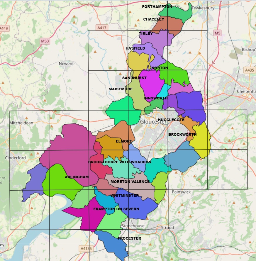
This is an initial Map showing the Parishes in Gloucester Rural District Council as they existed in the period from 1966 to 1974, when this pre 1974 District was abolished by the creation of post 1974 Districts of Forest of Dean, Stroud and Tewkesbury.
This map is created using QGIS Open Source Geographic Information System and the QGIS WebMap plugin and is experimental at this stage.
Gloucester Rural District Council Parishes Map